
High Risk Intersection Assessment – SH2 & SH35 Gisborne
Waka Kotahi wished to develop a prioritised intersection safety programme across the Gisborne State Highway network, which would reflect the level of risk presented by each individual intersection. The programme would also provide the recommended safety interventions for the highest risk intersections and identify ‘quick wins’ which have the opportunity to address obvious safety deficiencies.
Our team undertook a corridor wide safety assessment of SH2 and SH35. Personal Risk and Collective Risk utilising crash and traffic data which was then spatially mapped in GIS. The team then calculated the Level of Safety Service utilising the general flow crash prediction models contained within the Crash Compendium to the NZTA Economic Evaluation Manual.
- Client:
- Scale:
- Services:
- Date:
- Waka Kotahi NZTA
- Medium
- I&R / Spatial Analysis
- October 2020
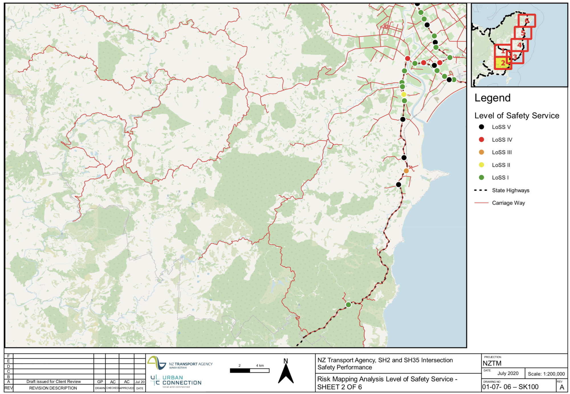
The method takes into account the speed environment, intersection type and traffic volume. Effectively the intersections that have the greatest differential between the modelled crash performance and the actual crash performance identify the intersections which are likely to achieve the greatest crash reduction benefits. This helped to identify sites for ‘quick wins’
From this 15 intersections where prioritised across the two corridors. Our team undertook more detailed crash analysis and site visits to develop recommendations for implementation under the Low Cost – Low Risk funding category.