UAV Rural Curve Study
UCL were engaged to undertake an assessment of a rural state highway curve for Waka Kotahi. UCL were selected because of our unique ability to undertake a 4 hour UAV survey of the curve with our tethered UAV / drone; and our ability to provide alternative data insights which cannot be achieved via traditional methods.
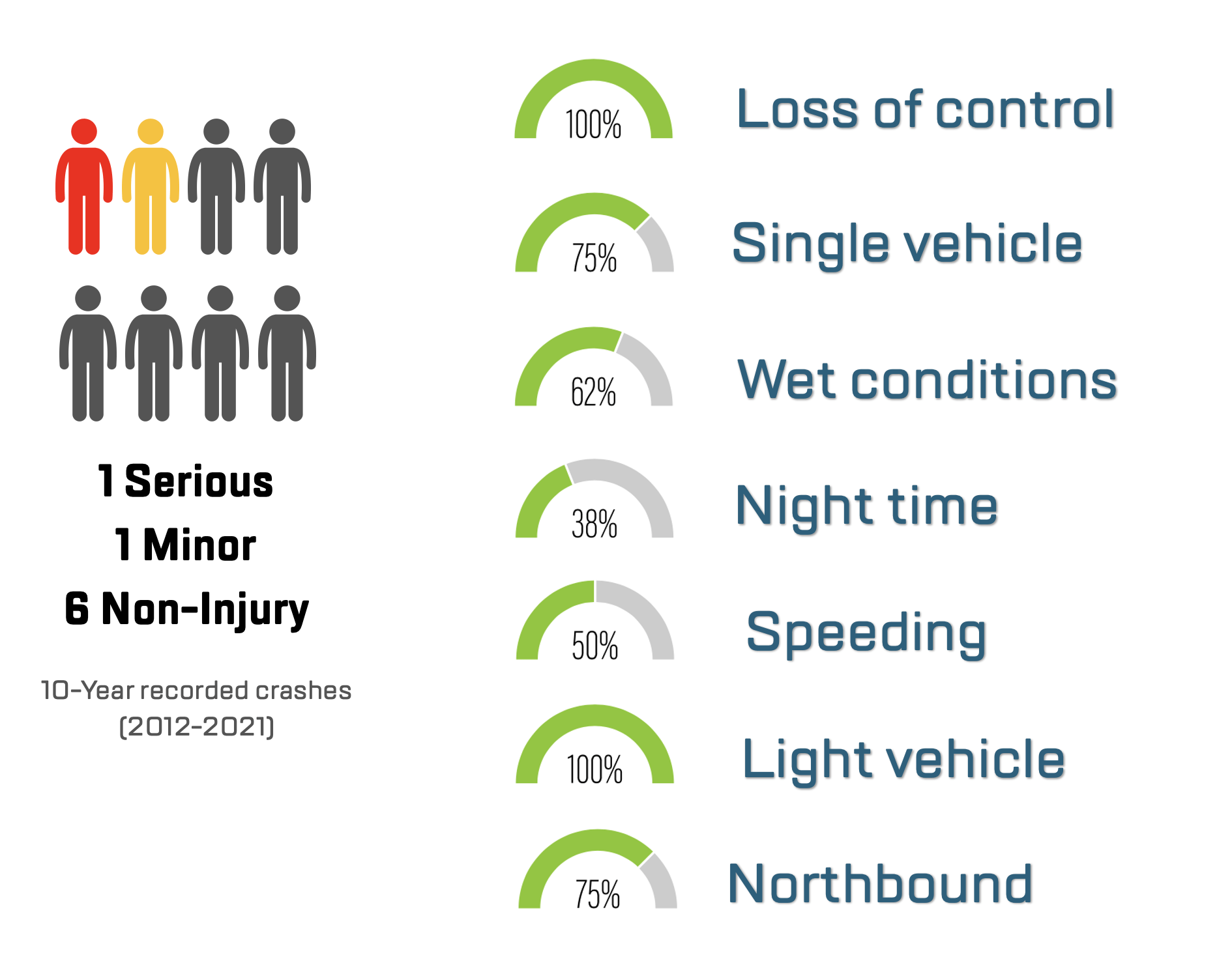
Utilising the UAV footage and AI our team assessed the speed at three points through the curve, on the approaches and identified behaviours which could result in crashes.
- Client:
- Scale:
- Services:
- Date:
- Waka Kotahi NZTA
- Small
- Road Safety Study
- 2022
The analysis revealed several key areas of concern:
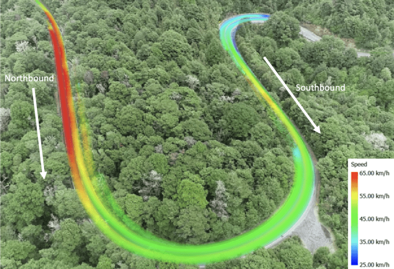
- The curve is posted at 35km/h. The average speed by light vehicles was 50km/h and 40km/h by heavy vehicles
- Approach speeds on the northbound approach, which had the majority of crashes, had a 85th percentile entry speed of 61km/h and approach speed of 70km/h for light vehicles
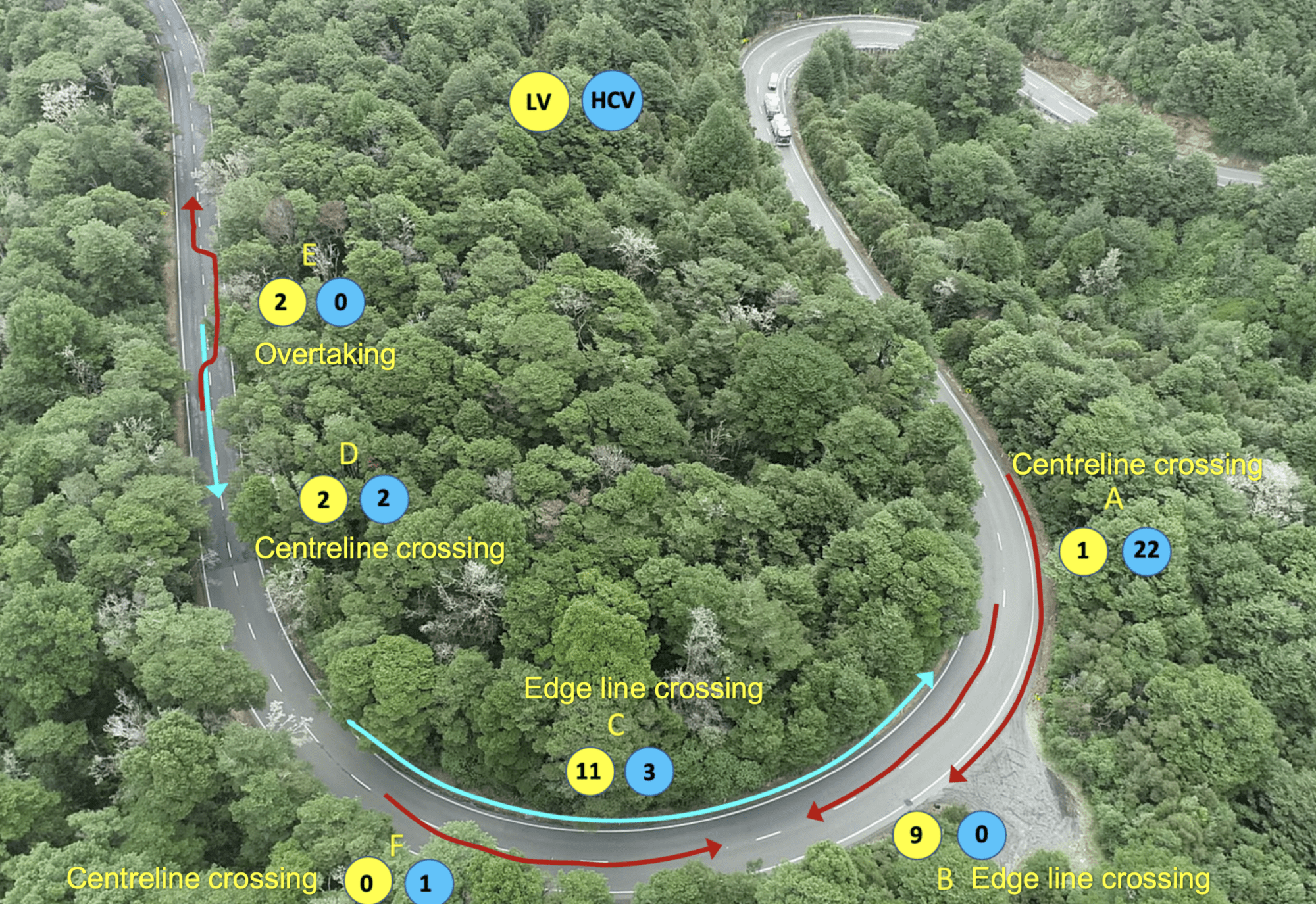
- Lane discipline was an issue with a significant number of vehicles crossing the centreline or edge line. Other behaviours observed included inappropriate overtaking. These are shown in the figure below
Our team developed an exposure and risk model for both light vehicles vs light vehicles, and light vehicles vs heavy vehicle crashes to determine the prioritisation of issues. This was then utilised to form the basis of options and recommendations.